Port Information

Geographical position
Lat: 45°15’N Long: 027°59’E

Location
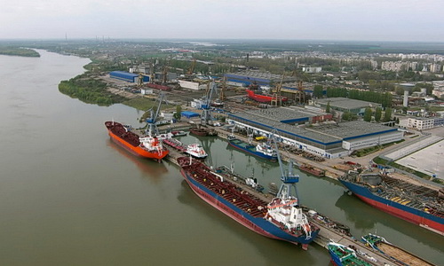
The Port of Braila is a river – maritime port on the Danube. It is situated on the left border of the Danube between Km 168+300 si Km 170+875.

Anchorage
The anchorage zones are established between Km 167 – 168 for the seagoing and river vessels and at Km 175 m for river vessels.

braila1_500
braila2_500

Berth details

Berth Length[m] Depth[m] Use
Old Port:
17-19 225 2,50 Service ships
20-23 700 3,50 General cargoes
24 105 7,30 General cargoes
Docuri Port:
25-27 496 3,5 General cargoes by floating cranes or ship’s gear.
30-32 300 3,5 Stones and paving and constructions materials
33 145 3,5 Ship repairs
34-38 558 7,3 General cargoes
39 210 3,5 Service ships
40 211 3,5 Ship repairs
Zona Aval Bazin Docuri:
42-44 396 3,5 Ro-ro and passengers

Port Sectors

Old Port (Km 169,8 – Km170,875) having 8 berths equipped with floating pontoons and used for passengers, fresh water supply, loading and discharging general cargoes by floating cranes and ship’s gear.

Docuri Port – Has 496 Km of pier on Danube front and 1,568 m of pier at basin. Main commodities are grains ex silo, bulk and general cargoes by shore cranes.

Downriver of Docuri Bazin – Has a 396 Mt. of pier at Danube waterfront use for passengers traffic

Copyright 2014 Hub Dacia SRL
Container Tracing